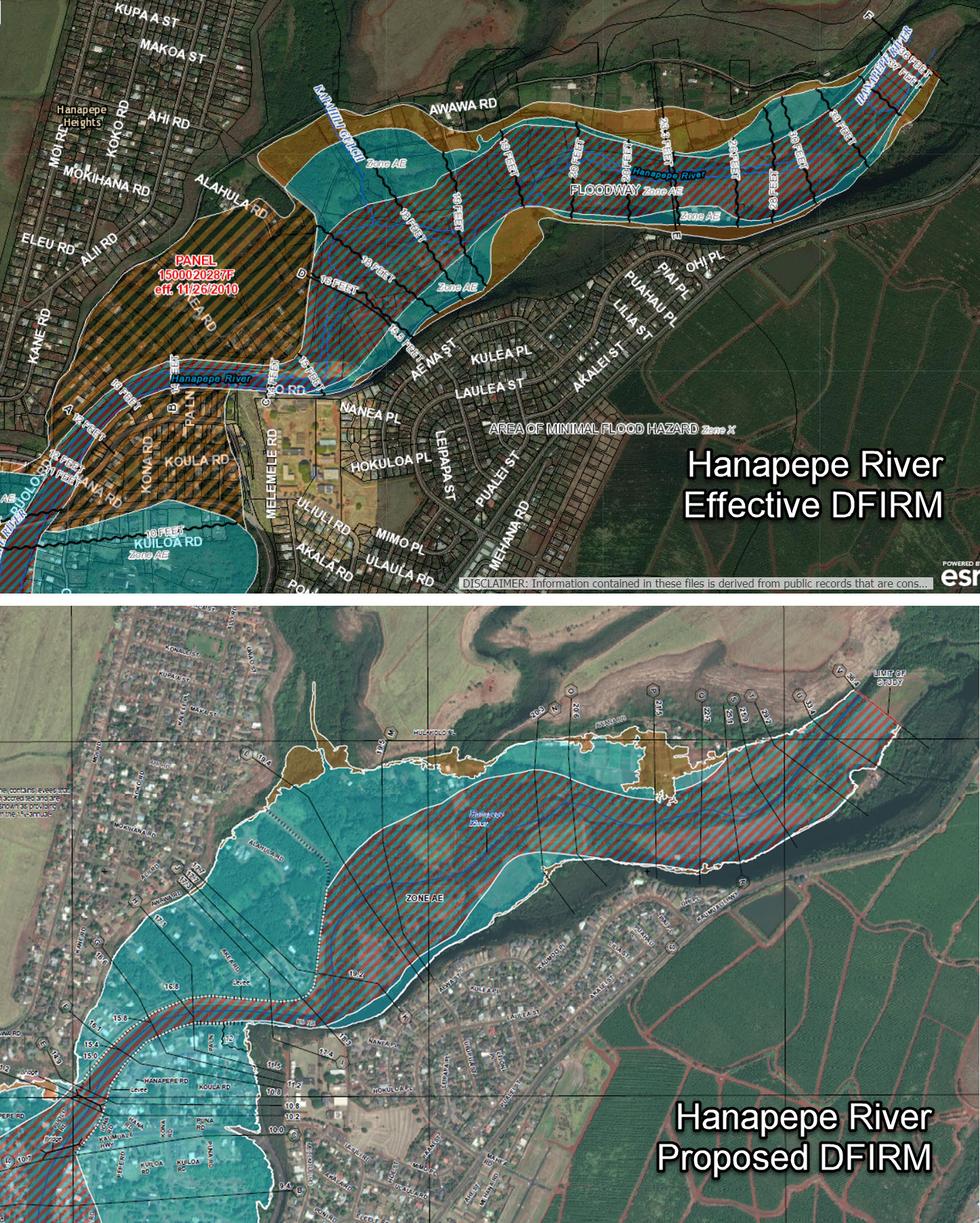
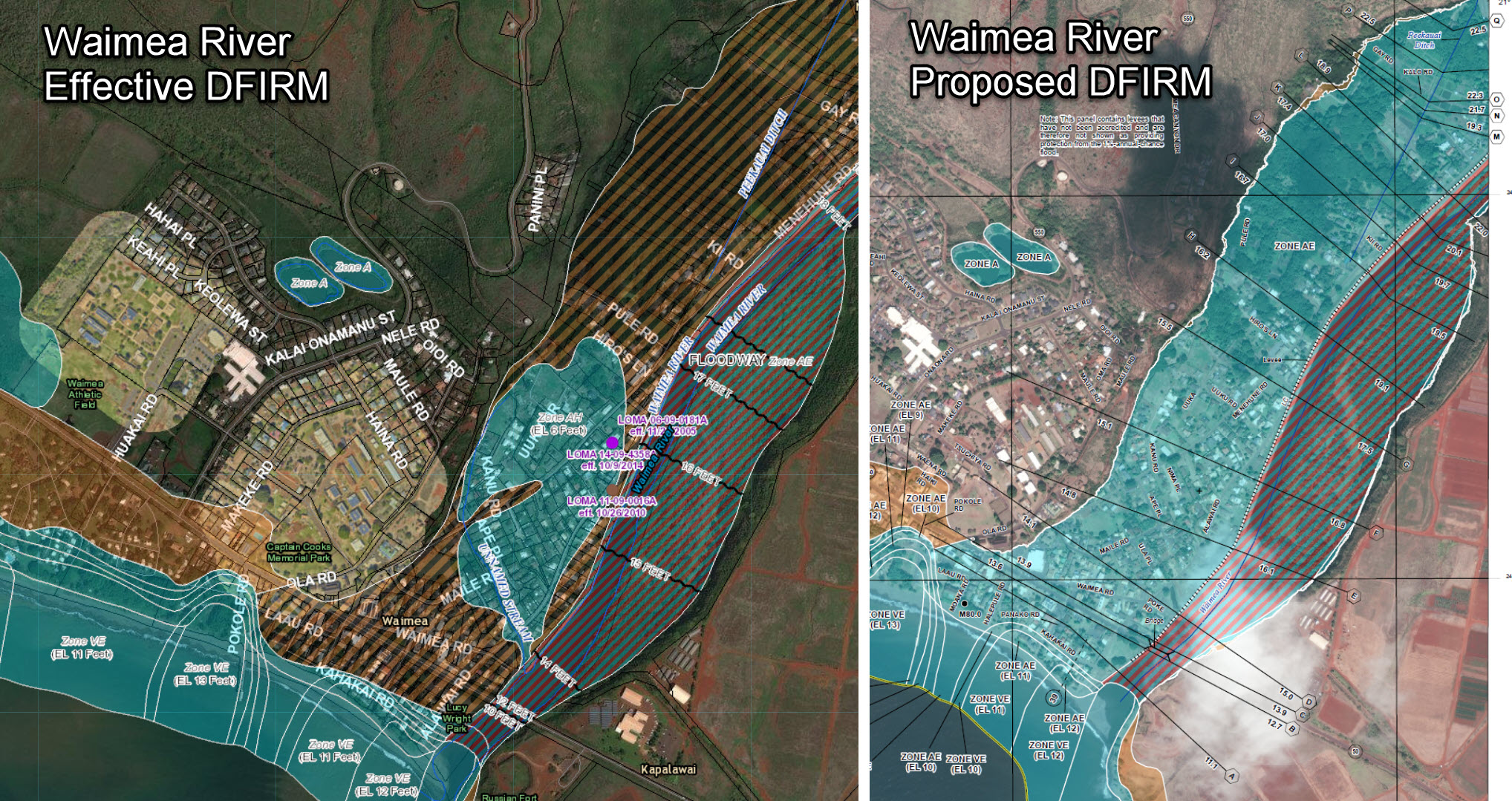
Waimea and Hanapepe Property Owners May Be Faced with Mandatory Flood Insurance Requirements
Posted on Apr 24, 2019 in NFIP News, UncategorizedThe Federal Emergency Management Agency (FEMA) has determined the Waimea and Hanapepe levees on Kaua‘i do not provide a high level of protection and are to be de-accredited. New preliminary flood maps, effective in 2020 show areas behind the Waimea and Hanapepe levees to be in a high-risk flood zone.
The DLNR Engineering Division, FEMA and Kaua’i County would like to inform home and business owners behind these levees that the new preliminary FEMA Digital Flood Insurance Rate Maps (DFIRM’s) and Flood Insurance Study (FIS) are available for viewing at the Kaua’i County Department of Public Works, Engineering Office at 4444 Rice Street, Suite 175 in Lihue.
The updated maps will help community officials and residents better identify known flood risks. A property’s flood risk may change and consequently so will the requirement for federally mandated flood insurance, as well as construction standards.
Affected residents and property owners are encouraged to attend community informational meetings scheduled next month in Waimea and Hanapepe:
|
Tuesday, May 21, 2019 Ele’ele Elementary School Cafeteria (4750 Uliuli Rd, Ele’ele, HI 96705) 6:00pm – 8:00pm |
|
Wednesday, May 22, 2019 Waimea Neighborhood Center (4556 Makeke Rd, Waimea, HI 96796) 6:00pm – 8:00pm |
Representatives from Kaua’i County, FEMA, and the DLNR Engineering Division will be available to answer questions, concerns, and provide information on the mapping timeline and appeals process at these community meetings.
Anyone requiring the use of auxiliary aids or having questions can contact the Kaua‘i County Floodplain Administrator, Stanford Iwamoto at (808) 241-4896 or siwamoto@kauai.gov before May 10, 2019.
More information regarding the proposed map change can be found on the FLOOD MAP page in our Wai Halana blog site.